

Area
This tool allows you to determine the perimeter and area of the territories marked on the map.
To open the Area tool, select the item of the same name (the icon ![]() ) in the tool menu on the left of the map.
) in the tool menu on the left of the map.
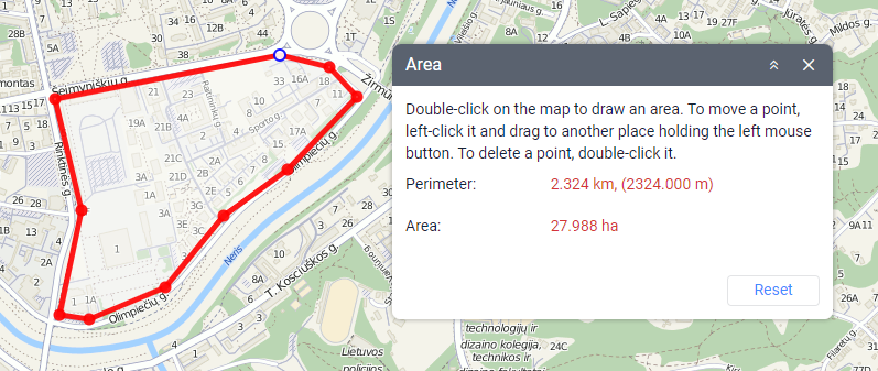
To measure the perimeter and area of an arbitrary sector, mark it on the map using the following actions:
- double-click to add a point;
- hover over a point and drag it to move it to another place;
- double-click on a point to delete it (available if there are more than two points);
- click Reset to delete all the points.
You can also zoom the map if necessary.
The area and perimeter of the marked territory are indicated in the tool window. The units of measurement depend on the measurement system selected in the user settings: hectares for the metric system, square miles and feet for the U. S. and imperial systems.
Was this helpful?
Download
 Download PDF file
Download Word document
Download PDF file
Download Word document
All pages
Only this page