This tool is used to measure distances between points. To open it, click on the icon ![]() in the tool menu on the left of the map.
in the tool menu on the left of the map.
When working with the tool, use the following actions:
- double-click to add a point;
- hover over a point and drag it to move it to another place;
- double-click on a point to delete it (available if there are more than two points);
- click Reset to delete all the points.
You can also zoom the map if necessary.
Measuring the distance between two points
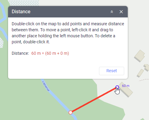
To measure the distance between two points, add them to the map. The mouse cursor should be on the second point. The result of measures is shown on the map next to the second point and in the tool window.
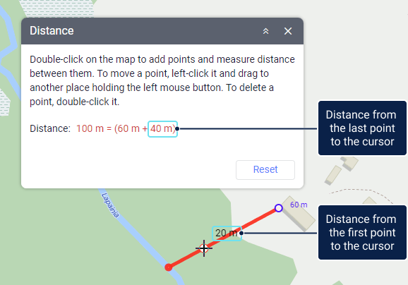
If you move the cursor to any part of the segment, the map shows the distance from the first point to the cursor, and the tool window displays the sum of the distances from the first to the second point and from the second point to the cursor. You can move the cursor to any location outside the segment: the tool window will show the distance from the last point to this location.
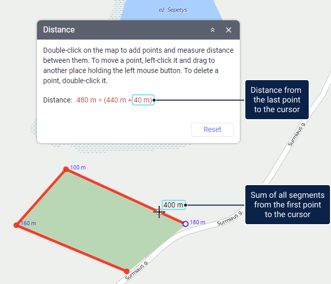
Measuring the distance between several points
Add several points. Next to each point, you can see the distance between this point and the previous one. The tool window shows the sum of these distances, provided that the mouse cursor is on the last point.
If you move the mouse cursor from the last point, then the map shows the sum of all segments from the first point to the cursor, and the tool window shows the sum of all segments from the first to the last point and the distance from the last point to the cursor.