

You can find additional information in the unit tooltip and in the extended unit information in the work list on the Monitoring tab.
Additional information includes the following data: the time of receiving the last message, location, presence in geofences, distance to the nearest geofence, speed, altitude, counters, satellites, connectivity settings, unit icon, sensor values, parameters, assigned drivers and trailers, custom fields, and maintenance intervals.
All the data items are activated in the Show additional information about the unit section of the user settings, except for the distance to the nearest geofence. This item is adjusted by the Distance from unit to geofence option from the Basic section.
Unit tooltip
A tooltip to a unit is displayed when you pause on a unit on the map, in the work list, in some dialog boxes, and so on. You can copy the information from the tooltip by selecting and saving the required fragment to the clipboard. You can select the content for this tooltip in the user settings. The tooltip for the unit may look like this:
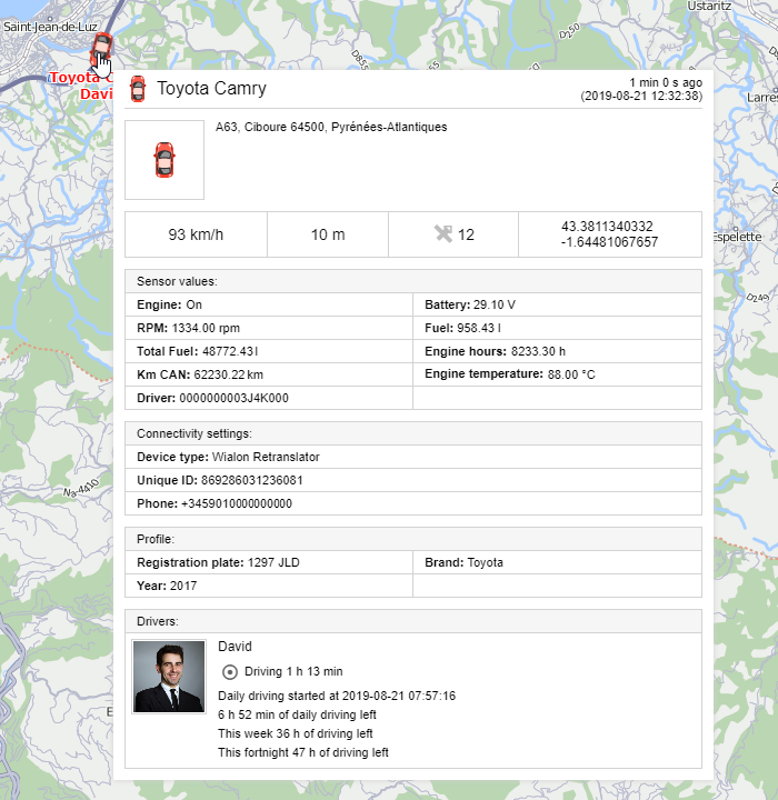
The characteristics are displayed in the tooltip in the same order as they appear on the Profile tab of the unit properties.
Extended unit information
Apart from the tooltip, you can obtain additional information about the unit by clicking on the unit icon in the work list on the Monitoring tab (both in the unit and unit group views). The content of the extended unit information is also adjusted in the user settings.
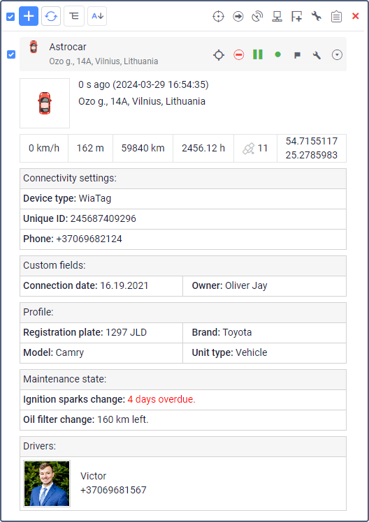
You can apply the extended view to any number of units in the work list. To hide the extended information, click on the unit icon again.
Depending on the unit settings, the values indicated in the pop-up window as well as in the expanded display can be presented in the metric (kilometers, meters, kilometers per hour, liters), American (miles, feet, miles per hour, gallons), or imperial (miles, feet, miles per hour, gallons) systems of measures.
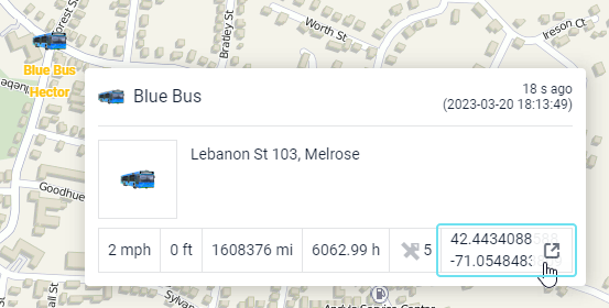
Opening the map by clicking on coordinates
When you click on the coordinates in the additional information or in the tooltip, it is possible to go to the site of a third-party map source.
To use this feature, select one of the following maps in the user settings:
- Google,
- Yandex,
- Bing,
- OSM.
If several maps are selected, a click on the coordinates opens the one that is higher on the list.
Monitoring options menu
To open the menu of monitoring options, click on the required unit on the map. This menu contains the same functions that are selected for the work list of the Monitoring tab. In addition, regardless of the selected options, the menu always contains the icons for generating a quick report and building a quick track.
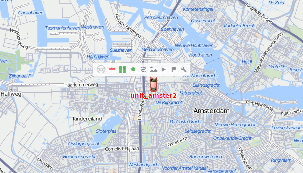
The menu of monitoring options doesn't contain information about the unit location, the tracking option, and the icon for removing the unit from the work list even if they are selected as monitoring options.
When a unit moves on the map, the menu moves with the unit. To close it, click anywhere outside the menu.