01.07.2021 v.4.1.2
In the new Hecterra version, we have added the Turning time setting. Thanks to it, you can specify the time within which the unit should make a turn outside the field.
The Turning time drop-down list is available in the Search settings section of the resource settings. You can select from 1 to 5 minutes in this list. The default value is 2 minutes.
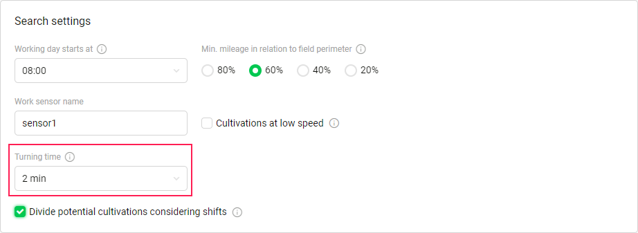
The turn made by a unit within the specified time is considered as part of a cultivation, is included in the mileage, and is taken into account when calculating the consumed fuel. If the unit has left the field for a time longer than the specified one, then this interval is excluded from the cultivation.
In case of any questions, write to alek@gurtam.com.
https://help.wialon.com/help/hecterra/en/what-s-new
Turning time setting
Now you can adjust the time required for the unit to make a turn outside the field: 1 to 5 minutes (2 minutes by default). This option allows calculating fuel and mileage in a cultivation more accurately.
3
10.06.2021 v.4.1.0
In this application version, we have added the Crop Rotation page, the ability to show the names of the fields on the map when creating and editing them, and fixed the discrepancy between the date formats in the settings and on the Crop Rotation tab.
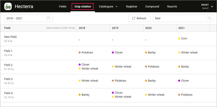
The navigation bar now contains a new item: Crop rotation. This page shows the crop rotation of all the fields and for all years in one table.
Now, when creating and editing fields, you can enable the display of the field names and areas on the map. Use the icon  to do this.
The date format which is used when specifying crop rotation has been adjusted to match the user settings.
In case of any questions, write to alek@gurtam.com.
https://help.wialon.com/help/hecterra/en/what-s-new
The following changes have been made in this application version:
- the “Crop rotation” item has been added to the top menu;
- the ability to display field names on the map has been included in the field creation and edit mode;
- the date format has been adjusted to match the user settings.
1
17.08.2021 v.5.0.0
We are glad to present you the pilot version of the planning module in Hecterra.
The navigation bar now contains a new item: Campaigns. This page is designed for medium-term planning in the application.
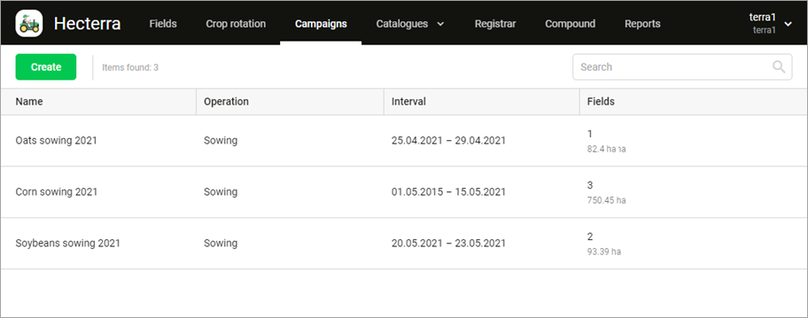
A campaign consists of performing one operation on several fields and can last from 2 to 30 days. You can use any number of fields in it. For example, you can create a campaign for sowing corn from May 1 to 10 or harvesting beets from September 7 to 25.
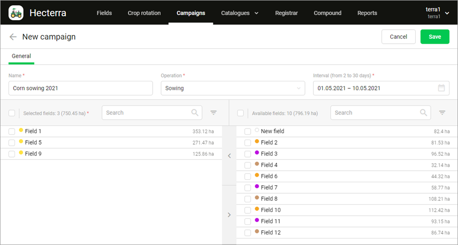
To create a campaign, specify the work period, operation, and fields. Next, register cultivations every day to update the status of the campaign execution. The charts will show you how much of the planned area is already cultivated and how much more is left, whether the plan is being fulfilled or not, and how much area was cultivated on each day of the campaign.
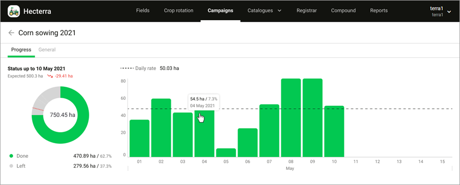
You can also create campaigns which correspond to past periods.
This is our first and very important step in the area of planning. We are open to your feedback and suggestions for further development of this module.
In case of any questions, write to alek@gurtam.com.
https://help.wialon.com/help/hecterra/en/what-s-new
Controlling production campaigns
What is the status of the planned work?
Now you can always answer this question using the campaign module. Plan a campaign by specifying its duration, operation, and fields, and control its execution in the charts.
4
19.04.2022 v.5.1.0
We have added a new type of report: a report by campaign. In this report, you can see how much work has been done in each field, as well as the fields that haven’t been cultivated yet as part of the campaign.
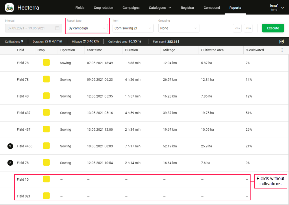
In case of any questions, write to alek@gurtam.com.
https://help.wialon.com/help/hecterra/en/what-s-new
In this application version, a new type of report is available. It shows information about the progress of work in all the fields of a specific campaign.
9
19.10.2021 v.5.0.2
In the previous update, we added the ability to save maps with fields to a PNG file. Now this function is also available for cultivations on the Registrar and Reports pages.
To save a part of the map with a potential or registered cultivation, open its properties and click on the icon  on the map.
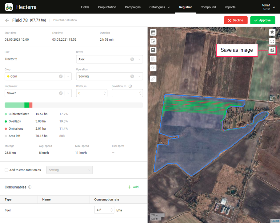
You can also save a part of the map with several cultivations which were registered for a certain period. To do this, execute a report for this period and switch to the map mode. Use the icon  to save a visible part of the map.
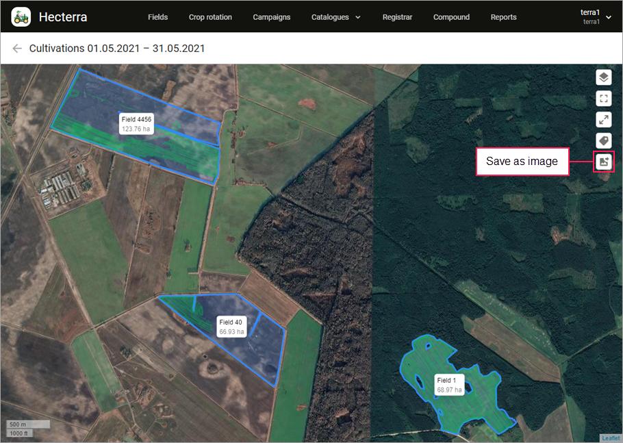
In case of any questions, write to alek@gurtam.com.
https://help.wialon.com/help/hecterra/en/what-s-new
In this version, we’ve added the ability to save a part of the map with cultivations as an image:
- on the “Registrar” page;
- on the “Reports” page.
6
21.09.2021 v.5.0.1
Thanks to this update, you can save maps with fields to a PNG file, change the settings of the cultivation search on the Registrar page, sort the table content on the Campaigns page, and update data in the charts on the Progress tab.
Now, on the Fields page, you can save a visible part of the map with fields to a PNG ( ) file. After that, you can print the file, send it by email, add it to the archive, and so on. Don’t forget to enable the Field names on the map option (
 ) if you want to see the names and area of the fields in the saved file.
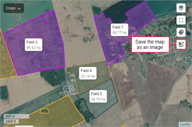
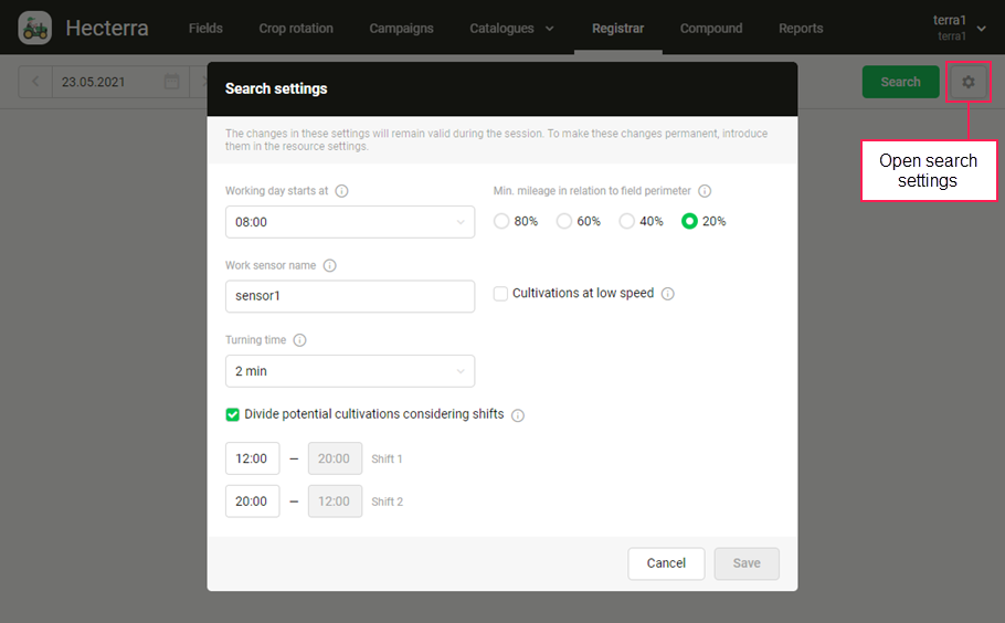
On the Registrar page, we have added the icon  which allows you to open the search settings. Here you can see the existing settings and, if necessary, change them. The new settings will be applied only during your session. They may come in handy if you want to use custom settings to search for potential cultivations without changing the basic settings on the Resource tab.
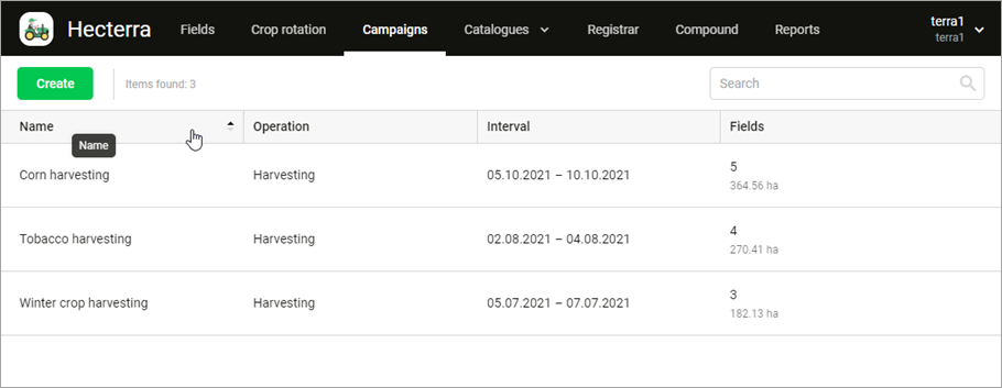
At the request of our forum users, we have added the ability to sort the table content on the Campaigns page by any column: campaign name, operation, interval, and number of fields.
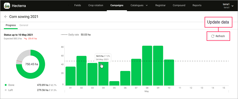
In addition, we have added a button which allows you to quickly update data in both charts on the Progress tab.
We hope you will like this update!
In case of any questions, write to alek@gurtam.com.
https://help.wialon.com/help/hecterra/en/what-s-new
The new features available in this version include:
- saving maps with fields to a PNG file on the “Fields” page;
- adjusting the cultivation search settings on the “Registrar” page;
- sorting data in the table on the “Campaigns” page.
5
24.06.2021 v.4.1.1
We are glad to present you a new version of Hecterra. We have added a setting for dividing the found potential cultivations by shifts and a button for refreshing the content of the Crop rotation page.
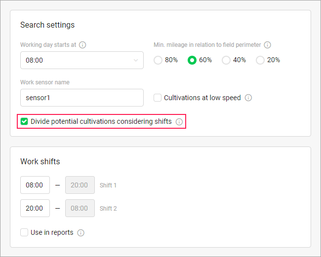
Do you want the potential cultivations found on the Registrar page to be divided by shifts without having to assign drivers in the monitoring system? Now this is possible due to the Divide potential cultivations considering shifts option. Enable it in the search settings and specify the start and end time of the shifts.
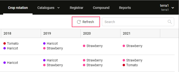
On the Crop rotation page, the Refresh button has appeared next to the search field. It allows refreshing the table in order to display the crop rotation data added on the Fields page: in a quick way (from the field list or on the map) or in the field properties.
In case of any questions, write to alek@gurtam.com.
https://help.wialon.com/help/hecterra/en/what-s-new
The following changes are available in this version:
- setting for searching for potential cultivations by shifts;
- button for refreshing the content of the “Crop rotation” page.
2
25.11.2021 v.5.0.4
Now you can monitor the campaign progress directly on the Dashboard page.
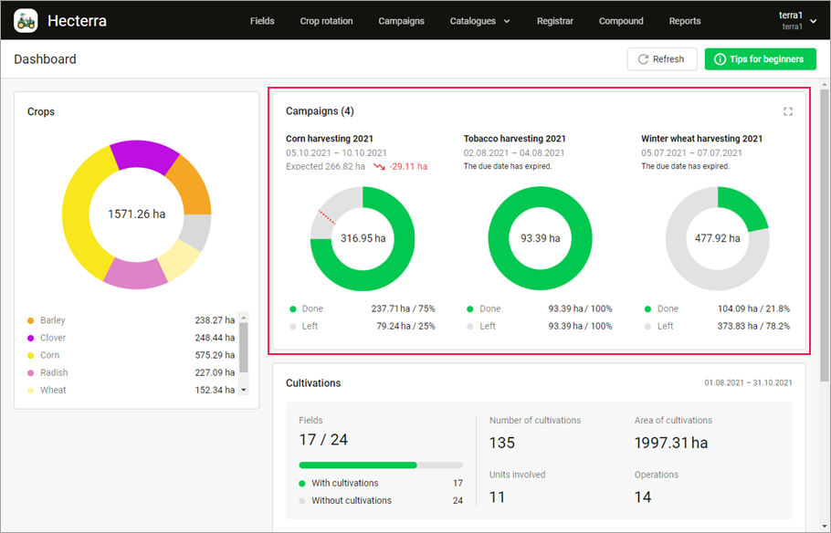
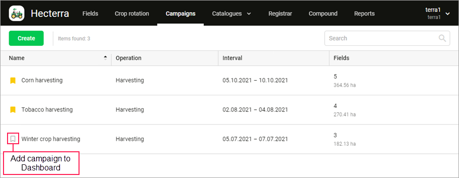
To add campaigns to the Dashboard, activate the icon  for them on the Campaigns page.
In case of any questions, write to alek@gurtam.com.
https://help.wialon.com/help/hecterra/en/what-s-new
Now you can add the charts of the campaign progress to the Dashboard.
7
28.12.2021 v.5.0.7
Now when you save a part of the map to a PNG file, the file name reflects its contents. For example, the file name with an image of a field includes the field name, the file name with an image of a cultivation includes the name of the field, unit, operation, and the date.
We have also added the ability to apply the White Label option (Personal Design) to the application logo. To order this service, contact your personal manager.
In case of any questions, write to alek@gurtam.com.
https://help.wialon.com/help/hecterra/en/what-s-new
The following changes are available in this version:
- now the names of the saved PNG files with the map depend on their contents;
- the White Label option (Personal Design) can be applied to the application logo.
8