Working with stops
The created stops are displayed as a list on the left side of the screen. The data about a stop includes its name, description (if specified), type (types), and information about the routes it is used in. When pointing to a stop, the buttons for its editing and deleting appear in the list.
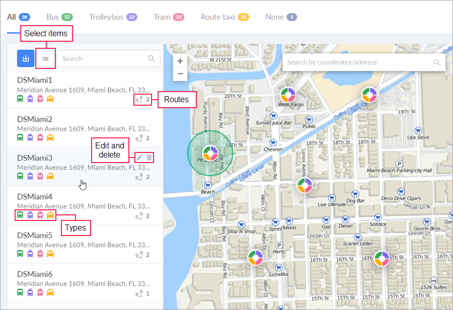
Stops can be filtered by type, to show, for instance, only trolleybus ones. To do this, select the required tab in the header of the work area. To quickly search for stops, you can use the dynamic search located directly above their list. The search works both by name and by description. When you apply filtering and search, the contents of both the list and the map are changed.
To quickly move to a stop on the map, click on it in the list. On the map, the stop is displayed as a round icon the color of which corresponds to the selected types of transport. The tooltip shows the name and description of the stop. Click on its icon to make the edit and delete buttons appear. For the stop that is in focus, the shape is displayed as well.
If the stops on the map overlap, they gather in clusters. The colors of the cluster reflect the types of its stops, and the numeric indicator in its central part is their number. Click on the cluster to automatically adjust the scale of the map so that all the hidden stops are displayed.
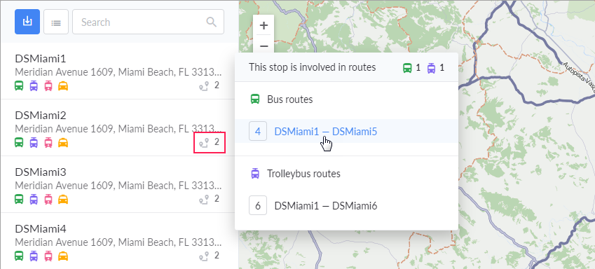
From the tooltip that appears after clicking on the icon  , you can go to the routes themselves. To do this, select the required one and left-click on it.