Geofences
Geofence, or geographical zone, is an area on the map that is important for user’s tracking purposes and requires special attention. Geofences can be used to control units’ activity in these areas or, on the contrary, outside them. You can choose an image for a geofence or add a description.
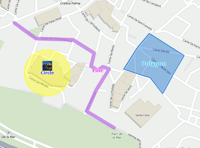
A geofence can have a shape of a line (for example, an avenue or any road), polygon (a city or park or plant), or circle with any radius.

Geofences are widely used in Wialon. Along with the map’s visual enrichment, they can be used in reports, notifications, and units’ tooltips. Geofences can also be used as check points for route configuration. Geofence’s tooltip may contain dynamically updated images and videos from external sources.
To open the Geofences panel, click the corresponding name in the top panel or choose the necessary item in the main menu customizer. Afterwards, choose a mode which allows you to work either with geofences or groups of geofences.

Geofence creation is available in the Geofences mode only, while the other options can be used in the Groups mode as well.