Map management
The Map management section is available only in the CMS Manager and for top accounts. In this section, you can add, edit, and delete maps. A standard table contains all the added maps that can be used as basemap, routing source, geodata source, and distance matrix. The available services of the map are marked with the icon ![]() .
.
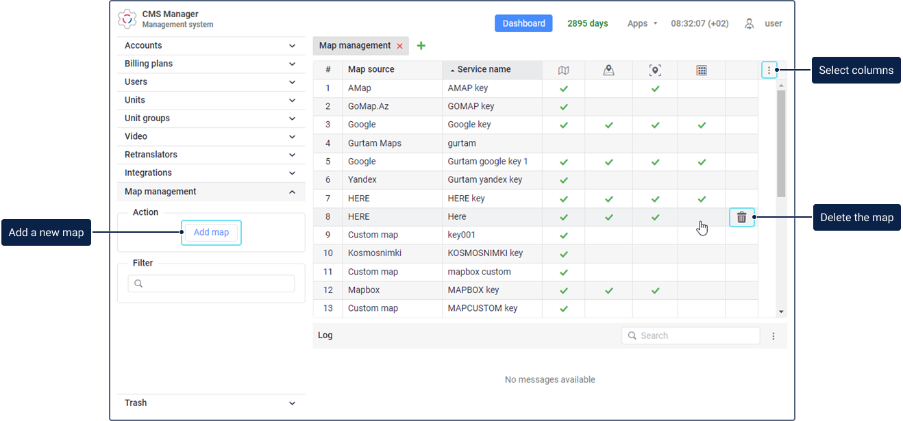
When adding a map, you should specify the name of the service with which you can control access to the map and its services. Thus, the top account user can enable or disable this service in the properties of the required billing plans or subordinate accounts. See more about other map settings.
Map settings
The table below describes the settings that can be available when adding maps. The required settings are marked with an asterisk (*).
| Setting | Description |
|---|---|
| Map source* | Using the Custom map source, you can add a custom map. It allows you to specify the server of any map source. Custom maps can only be used as basemaps.The list doesn’t contain Gurtam Maps because they are available by default. |
| Service name* | The name of the service which should be displayed in the list of services in the account or billing plan properties. Using this service, you can manage the access to the map services. |
| Key* | The API key purchased to connect the required map source. For some maps, a free API key can be used. In this case, you can get it on the website of the required service. The Key field is optional. |
| Service type* | The Basemap type allows you to display maps. |
| Layers | The setting that allows you to add graphic layers of maps. The following fields are available:
To add a layer, specify its name and value and click on the icon  in its row. in its row. |
| Overlay | If this option is enabled, the map is shown as an additional layer over the base layer. If the option is disabled, it is shown as a base layer. |
| Map name* | Here you should specify the map name that should be shown in the list of basemaps in the monitoring system. |
| Map server* | Here you should specify a link to the map server. |
| Zoom | In the From and To fields, you should specify the minimum and maximum scale values, respectively. The available values are from 0 to 24. |
| Sites* | The sites on which you can use the added API key. You should select at least one site. |
Adding maps
When adding a map, you should specify the following required settings:
To change the properties of the added map, click on its row in the table. To delete the map, point to its row, click on the icon , and confirm the action.
Next, in order for the map to become available to the user, enable the service corresponding to the added map key (Access to maps: …) in the properties of the user’s billing plan or account.