Distance
To measure the distance from one point to another, select the Distance tool. To indicate the initial point, double-click on any place of the map. Then, sequentially add new points. You can move the map or zoom it using any of the ways described on the Map page.
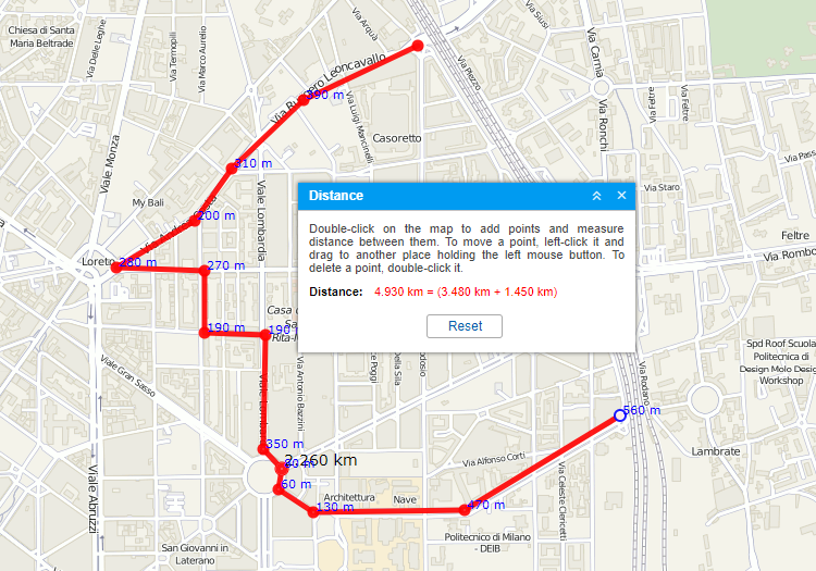
Next to each point, the distance from the previous point is indicated. The total sum of all segments can be calculated in the window of the Distance tool. To know the sum, place the mouse cursor over the last point (a white dot with the blue border). If the cursor is moved to another place, the total sum of segments will also include the distance to the current position of the cursor. In brackets, you will see the sum of all segments already mapped onto the map + the distance to the cursor. If the cursor is placed over the last added point, the added distance is 0m.
Move the cursor along the already added line to get the distance from the starting point to the current cursor position. The cursor position is marked with a white dot. When you pause the mouse cursor on it, the cursor takes the form of a plus sign (+). The caption with a black font shows the distance from the first point to the selected position.
To clear the map and start measurements again, use the Reset button.