Creating a geofence
Who can do it: Service provider, Customer
Where: Wialon Platform FleetSpace
Customers create individual geofences in Wialon Platform FleetSpace. When creating a geofence, it must be assigned to one of the Geofence groups defined by the service provider, inheriting its properties.
To create a geofence in Wialon Platform FleetSpace:
-
Log in to Wialon Platform FleetSpace.
-
Navigate to the Geofences page in the sidebar. If the section isn’t available, add it using the editor mode.
-
Click New geofence to begin creating a new geofence.
-
Select the shape: Polygon, Circle or Corridor.
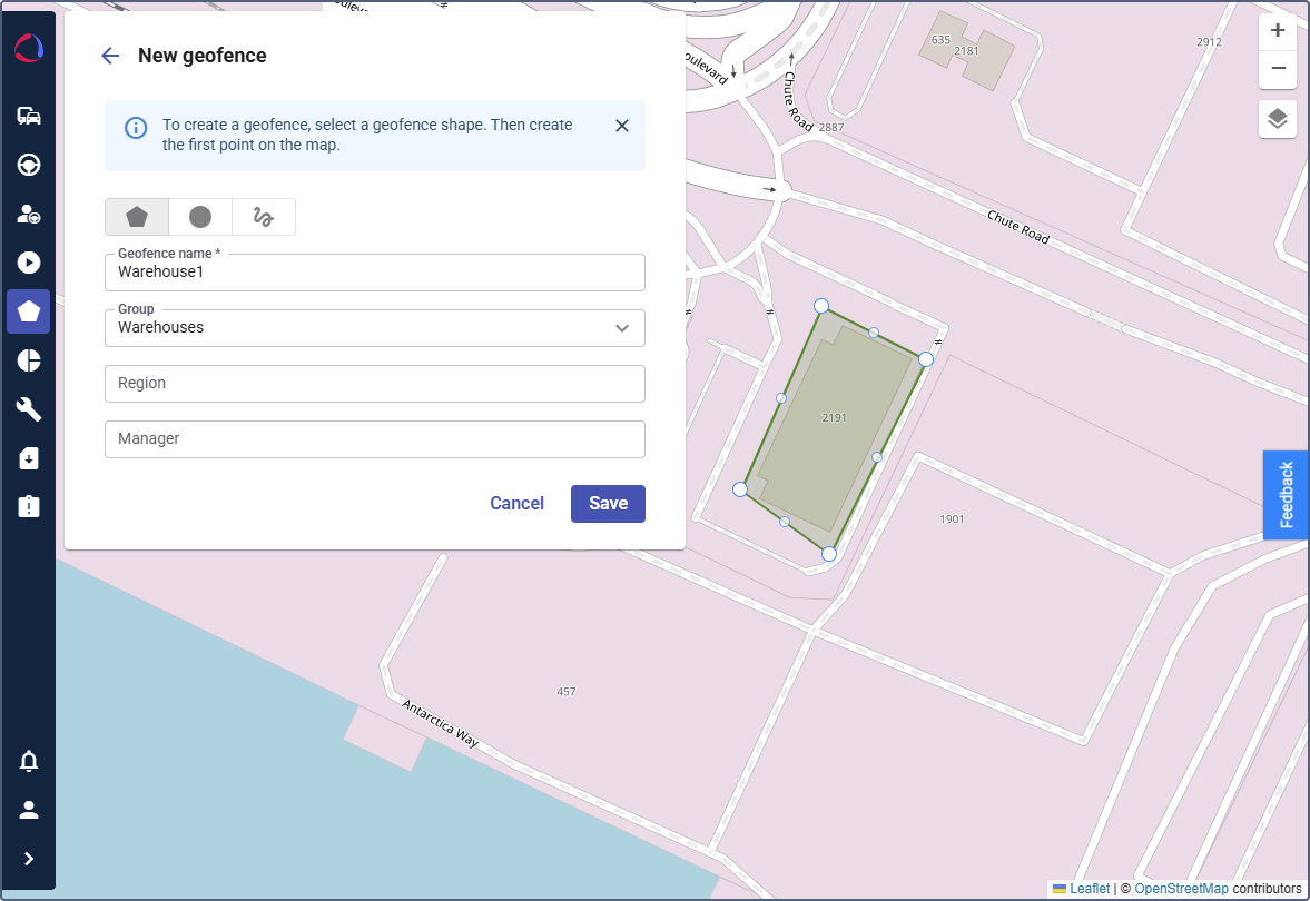
-
For the Polygon type, click point by point along the required area on the map to create a polygon that covers the entire territory.
-
Double-click the last point to complete the shape. For Circle geofences, enter the radius value in meters in the Radius field. The fields Latitude and Longitude are filled in automatically. For Corridor geofences, enter the width value in meters in the Width field.
-
In the New geofence window, fill in the properties:
- Enter a descriptive geofence name (for example,
Warehouse). - (Optional): Assign this geofence to a group.
- If you assigned a group, complete the additional properties with relevant information.
- Enter a descriptive geofence name (for example,
-
Click Save.
Now you can use the geofence for automation and reporting.